18 Jul 2025 The Danish Hunters’ Association Wins Award for Weight Data Collection System
The SmartGIS Award was presented with the following remarks: “Building on a strong culture of volunteerism, the association has succeeded in combining technological innovation with sustainable wildlife management – and made it easy, efficient, and anonymous for hunters to report data (…).”
During the 2024/2025 hunting season, the Danish Hunters’ Association (Danmarks Jægerforbund) collected weight data on dabbling ducks and eiders using a new approach. In collaboration with the company Geoinfo, a new system was established to make it as easy as possible for hunters to submit weight data. Already by September, it became clear that the system had been well received, as more data had been collected within the first month than during the entire previous season (2023/2024).
Geoinfo is the Danish distributor of the world’s leading GIS and analysis software, ArcGIS, which is used in areas such as infrastructure and conservation. The Danish Hunters’ Association collaborates with Geoinfo on projects requiring GIS solutions (geographic data). This long-standing partnership spans a wide range of projects – from work with shooting ranges and bird census to the collection of weight data.
Simple and User-Friendly
Based on the success of the initiative, the Hunters’ Association and Geoinfo co-presented a presentation about the weight data collection project at Geoinfo’s annual conference. The conference is aimed at a wide range of organizations that work with geographic data in various capacities, such as municipalities, the military, utility companies, and many private businesses. The aim of the presentation was to showcase how a relatively simple and user-friendly solution had been successfully implemented. The main goal throughout has been to improve population monitoring, which is a clear priority for the Danish Hunters’ Association.
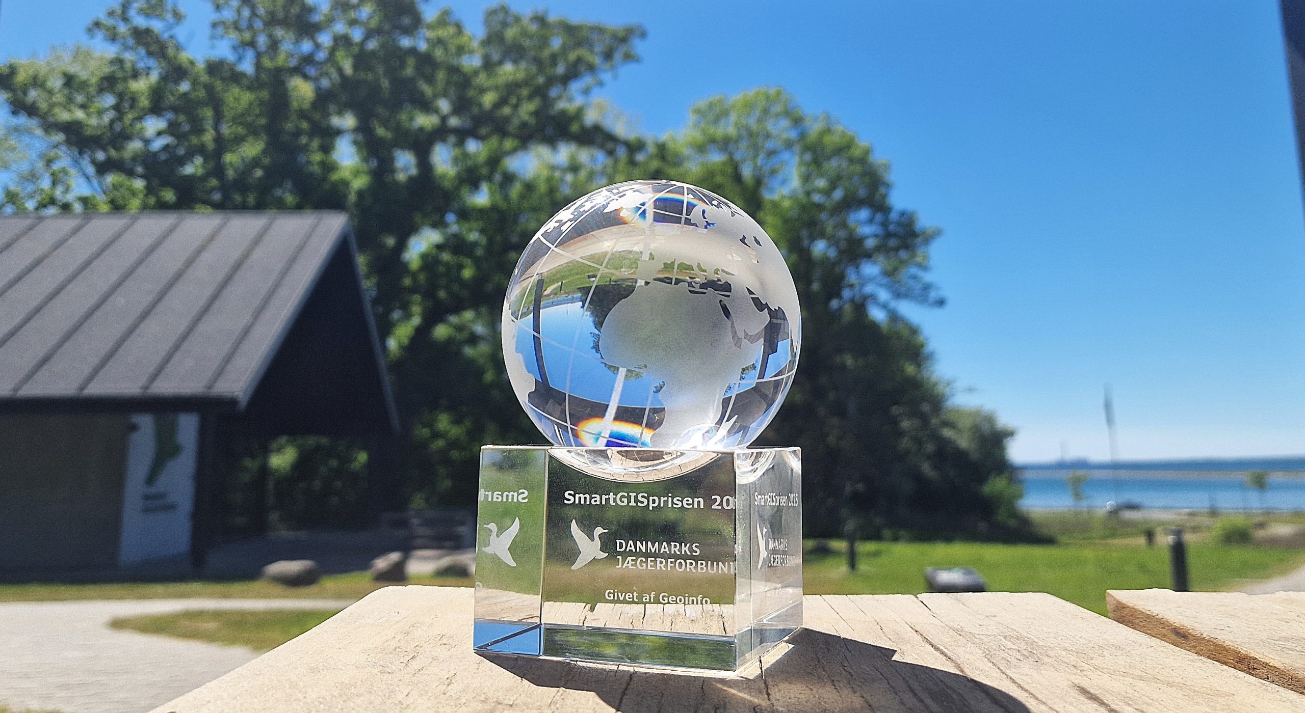
At the conference, the Danish Hunters’ Association received the SmartGIS Award for the solution developed for weight data collection. The SmartGIS Award is given to particularly creative and innovative geographic solutions. The award citation reads:
“The Danish Hunters’ Association receives this year’s SmartGIS Award for their targeted efforts to promote the use of ArcGIS across the organization. Building on a strong culture of volunteerism, the association has succeeded in combining technological innovation with sustainable wildlife management – and made it easy, efficient, and anonymous for hunters to report data. The solution benefits both hunting organizations and authorities seeking to base decisions and wildlife management on data. At the same time, dedicated volunteers with no prior GIS experience have risen to the challenge and worked purposefully with apps and workflows in the ArcGIS platform.”
Focus on the Next Season
For the Danish Hunters’ Association, it is gratifying to receive recognition from a company whose core expertise lies in a highly technical field. However, the overriding focus for the association is to ensure that hunters continue to support population monitoring efforts. This progress would not have been possible without the many passionate volunteers who work tirelessly to preserve hunting opportunities for dabbling ducks and eiders by contributing to, promoting, and supporting improved monitoring.
Therefore, weight data will also be collected in the next season for dabbling ducks and eiders, hopefully with even greater participation.
Text: Zacharias Jakobsen
Photo: Jacob Munkholm Jensen
Danmarks Jaegerforbund’s publication